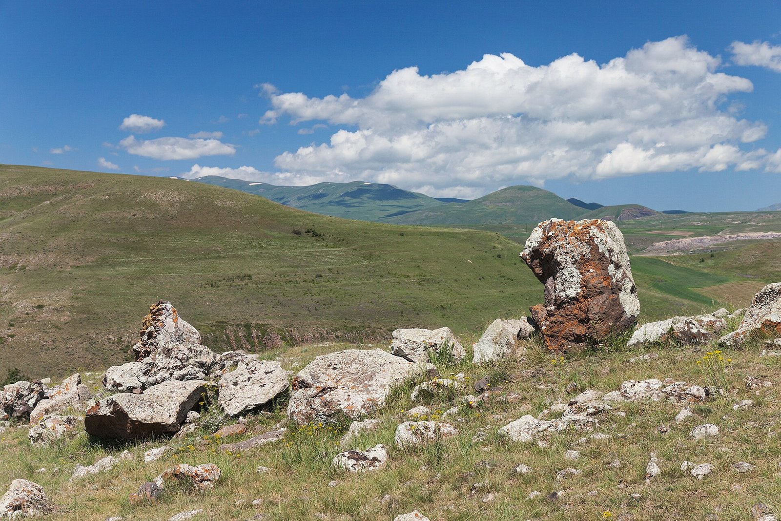
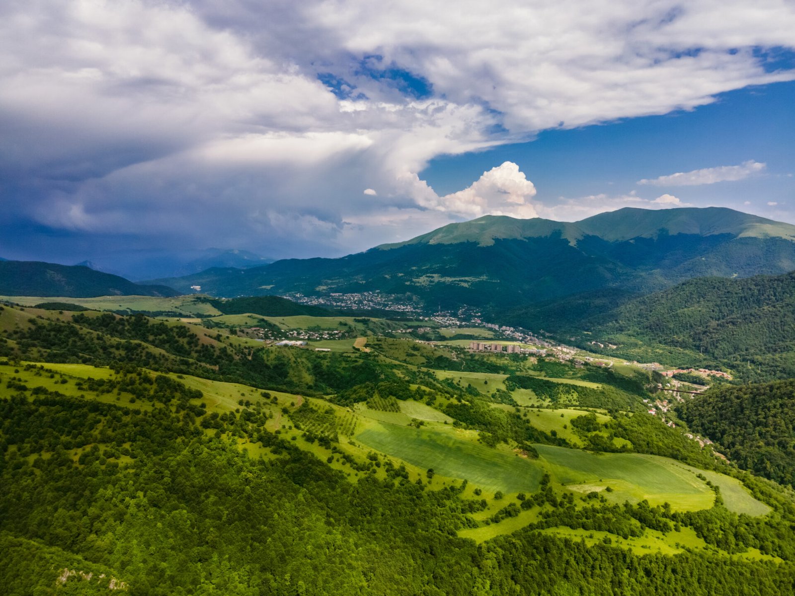
Dilijan is the green exception in Armenia. Ninety minutes north of Yerevan, the road comes out of a tunnel into a valley of oak and beech forest with mist hanging in it, and the country you thought you knew is gone. Armenians call it their Switzerland. It has two of the finest monasteries in the country, a national park full of trails, and a pace that makes you stay longer than planned.
| Quick facts | |
|---|---|
| Where | Tavush province, northern Armenia |
| Altitude | Town roughly 1,300 to 1,500 m |
| From Yerevan | 95 km, about 1.5 hours on the M4 |
| From Lake Sevan | About 40 minutes through the tunnel |
| National park | Dilijan National Park, around 240 km2 of forest |
| Main sights | Haghartsin, Goshavank, Parz Lake, Sharambeyan Street |
| Best hike | Parz Lake to Goshavank, about 8 km |
| Best months | Late May to June, and October for autumn colour |
The town itself
Dilijan is small and a little scruffy in places, a mix of Soviet apartment blocks, wooden balconied houses on the hillsides, and a growing number of guesthouses and cafes. The centre of gravity for visitors is Sharambeyan Street, a short restored lane of nineteenth century craftsmen’s houses with carved wooden balconies, now holding workshops, a small museum, a ceramics studio and a couple of places to eat. It is unashamedly a heritage set piece, and it is charming anyway.
On the main road stands a bronze group of three characters from Mimino, the 1977 Soviet comedy in which a Dilijan local claims the town’s spring water is the second best in the world. Every Armenian knows the scene, and every Armenian will quote it to you. Drink from the fountains. The water genuinely is very good, and the bottled Dilijan mineral water you will see everywhere comes from here.
The other thing to know about the town is UWC Dilijan, an international boarding school on the hill that brought money, students from sixty countries, and a surprisingly good cultural programme to a place of fifteen thousand people. It explains why you can get a proper flat white in a mountain town in Tavush.
Haghartsin monastery
Haghartsin is about eight kilometres east of Dilijan and then a few kilometres up a side road into dense forest. You come round a bend and it is simply there, three churches and a refectory in a clearing, with wooded ridges rising on all sides. Nothing else in Armenia is set like this. Most monasteries here command a view; Haghartsin is hidden inside one.
The complex dates from the tenth to thirteenth centuries, with the main church of Surb Astvatsatsin finished in 1281. The thirteenth century refectory, a long vaulted hall on crossing arches, is the piece architects come to see. There is also an ancient walnut tree in the grounds that predates most of the buildings around it.
Haghartsin was comprehensively restored between 2008 and 2013 with funding from the ruler of Sharjah, who visited and was moved by the state of the ruins. Some purists grumble that the restoration is too clean. Judge for yourself. Go early or late in the day and you may have it to yourself, which is when the forest silence does its work.
Goshavank
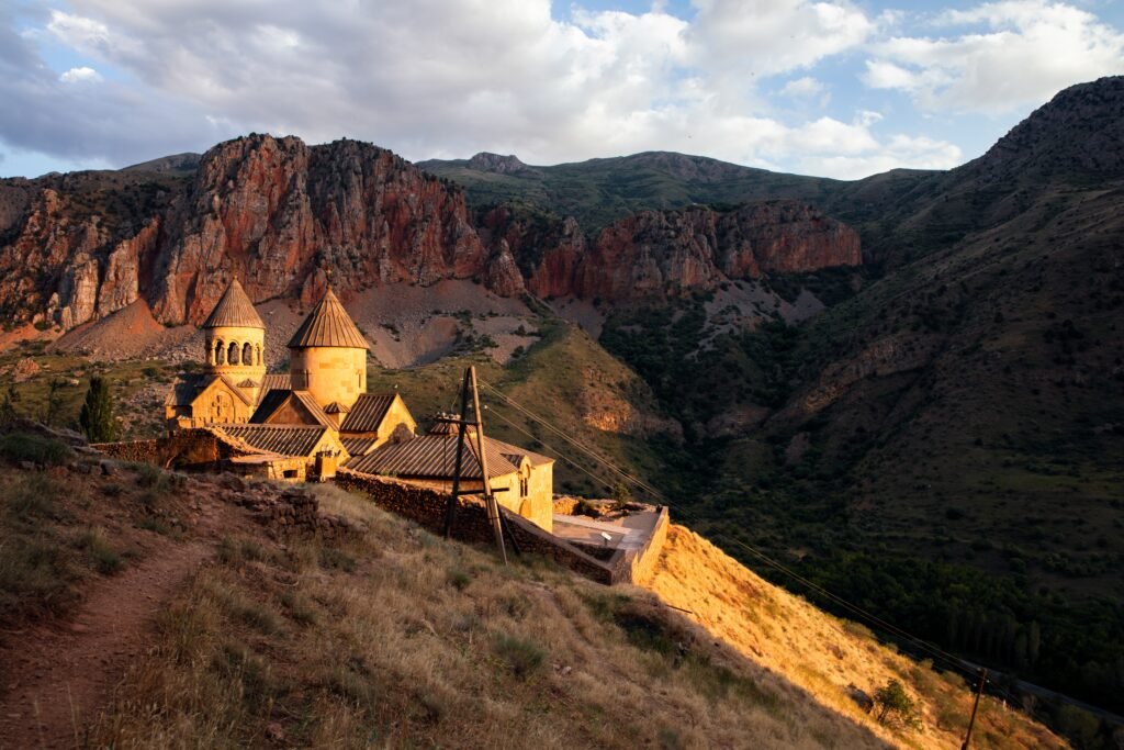
Twenty kilometres east, in the village of Gosh, Goshavank was founded in 1188 by Mkhitar Gosh, a scholar, fabulist and jurist who wrote the first Armenian law code. His grave is in the small chapel above the complex. Unlike Haghartsin, Goshavank sits openly in the middle of a village, surrounded by houses and gardens, which gives it a lived in feeling.
The thing everyone comes for is a khachkar: the 1291 cross stone carved by the master Poghos, standing against the outer wall of Surb Grigor Lusavorich chapel. It is called the needle lace khachkar because the stone has been cut so finely it looks like textile. Get close, and look at the tiny openwork. Armenian stone carving never went further than this.
There is also a well preserved scriptorium and bell tower and, if the caretaker is around, a chance to see the old manuscript room. Entry is free at both monasteries. Read our wider round up of the best monasteries in Armenia for how these two compare with Tatev, Geghard and Haghpat.
Parz Lake
Parz Lich, meaning clear lake, sits at about 1,350 metres in the forest roughly ten kilometres from town. It is small, ringed by trees, and on a still morning it mirrors the whole hillside. It is also the most developed spot in the park: rowing boats, pedalos, a restaurant, a zipline across the water, and on summer weekends a lot of Armenian families having a very good time. Come early if you want the quiet version.
For most visitors Parz Lake is best treated as a trailhead rather than a destination. Park there, walk into the forest, and come back to the boats afterwards.
Hiking in Dilijan National Park
Dilijan National Park protects around 240 square kilometres of some of the densest forest in the South Caucasus, and it holds the best waymarked hiking network in Armenia thanks to the Transcaucasian Trail project. Trails are marked with red and white blazes and are genuinely followable, which is not true everywhere in the country.
Parz Lake to Goshavank
The classic. About eight kilometres, three to four hours, mostly gentle descent through beech and hornbeam forest with a few open meadows. It ends at Goshavank, which makes a perfect finish. Arrange a taxi to collect you in Gosh, or walk fifteen minutes further to Gosh Lake first. This is the walk to do if you only do one.
Jukhtak Vank and Matosavank
Two small eleventh to thirteenth century monasteries in the forest on the western edge of town, reachable on foot from Dilijan itself. Jukhtak Vank, the twin monastery, is two little churches in a clearing. Matosavank is further overgrown and feels genuinely lost. Under two hours return for either, and they need no transport at all.
Longer options
The Transcaucasian Trail runs through the park on multi day sections north towards Ijevan and the Lori border. If you have the legs and the gear, this is the finest long distance walking in the country. Our guide to hiking in Armenia covers routes, seasons and what to carry.
Practical notes for walkers: the forest holds ticks from April to July, so check yourself afterwards. Shepherd dogs are around the upper meadows and should be given space. Water sources are frequent but treat what you take. Mobile coverage disappears in the valleys.
Beyond Dilijan: the rest of Tavush
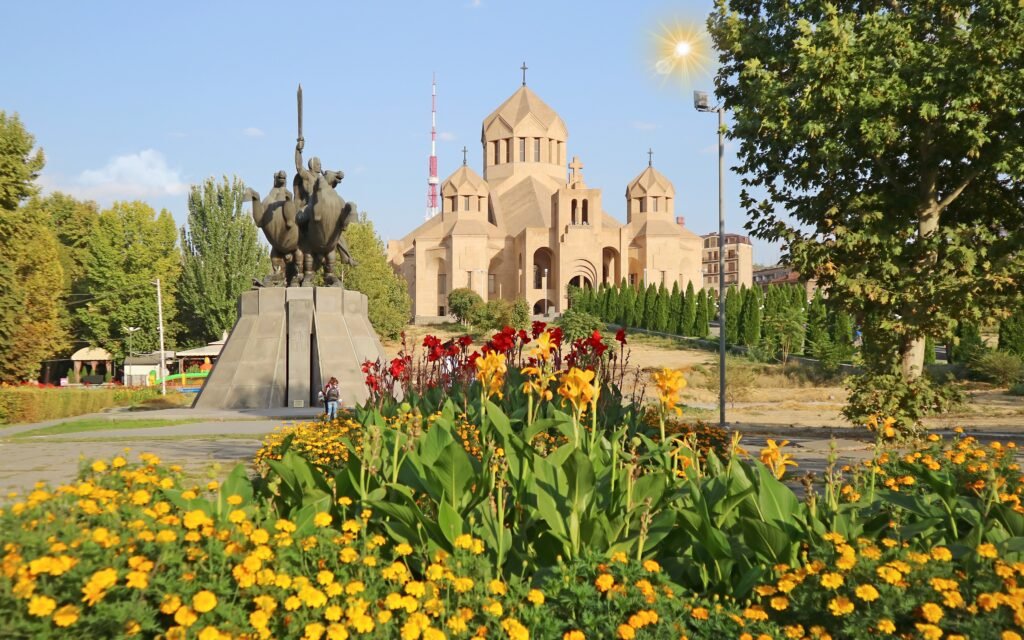
Tavush province keeps going north and gets wilder. Ijevan, the provincial capital, is a working town with a carpet factory and a decent market. Half an hour beyond it, above the village of Yenokavan, is Lastiver: a gorge with a waterfall, a river, and caves in the cliff face that hold carvings of uncertain age, reached on a steep forty minute walk down. It is one of the most atmospheric places in northern Armenia. The same area has Yell Extreme Park, with one of the longer ziplines in the region, if you want your forest with adrenaline.
Continue west and you are into Lori with Haghpat and Sanahin, the UNESCO listed monasteries, and the Debed canyon. That region is covered in our guide to northern Armenia, Gyumri and Lori.
Getting there
From Yerevan take the M4 north past Lake Sevan and through the Dilijan tunnel, which drops you straight into the forest. It is 95 kilometres and about an hour and a half. Marshrutkas run from Yerevan’s Northern bus station several times a day and cost very little, and shared taxis leave when full. A private taxi from Yerevan is affordable split between two or three people.
Because the lake is right on the way, Sevan and Dilijan are the natural pairing, and it is the single best full day out of the capital. See our Lake Sevan guide for that half of the trip, and our Lake Sevan and Dilijan day trip if you want it organised. More options are in our list of day trips from Yerevan.
Around Dilijan itself you will want a taxi for Haghartsin and Goshavank, since neither is walkable from town and public transport is minimal. Local drivers charge modest hourly or half day rates and guesthouses will arrange it.
We take independent travellers to Dilijan with real time in the forest, not just a photo stop at Haghartsin on the way back from the lake. Hiking, monasteries or both, at your pace. See our tours.
Where to stay and eat
Dilijan has the widest range of accommodation outside Yerevan and the lake: family guesthouses from around 20 to 35 euros a double in 2026, mid range hotels at 40 to 80, and a couple of design hotels well above that. Staying in the forest outside town is lovely but leaves you dependent on a car. Staying in town puts you within walking distance of the old street and the forest monastery paths.
Food is homely rather than refined: trout, barbecue, forest mushroom dishes in autumn, jams and preserves from the market. Ask your guesthouse about a home cooked dinner, which is almost always better and cheaper than a restaurant here.
When to come
Late May and June for green and wildflowers. October, especially the first three weeks, for the beech forest turning gold and copper, which is the single most beautiful thing in northern Armenia. July and August are warm but five to ten degrees cooler than Yerevan, which is exactly why Armenians escape here. Winter is snowy, quiet and beautiful, with the monasteries almost empty, though hiking becomes limited. For the full picture of the country by season, start with our Armenia travel guide.
Practical notes
- Bring a rain layer whatever the forecast. Dilijan gets far more rain than the rest of Armenia.
- Proper shoes for the trails. The forest paths are muddy for days after rain.
- Cash for village shops, taxis and small guesthouses; cards work in town.
- Cover shoulders and knees inside churches.
- Check yourself for ticks after walking between April and July.
- Allow a minimum of one full day, two if you want to walk.
Frequently asked questions
Why is Dilijan called the Armenian Switzerland?
Because it is the green exception in a largely dry country. Dilijan sits at around 1,300 to 1,500 metres in a forested valley of oak, hornbeam and beech, with mist in the mornings, running water everywhere and a mild climate. Soviet writers and composers came here to work, which cemented the nickname.
How far is Dilijan from Yerevan?
Around 95 kilometres, about an hour and a half by road on the M4 via Lake Sevan and the Dilijan tunnel. It is also only about forty minutes from the shore of Lake Sevan, which is why the two are almost always combined into one day trip from the capital.
What is the best hike around Dilijan?
For most visitors it is the waymarked Transcaucasian Trail section from Parz Lake to Goshavank, roughly eight kilometres of mostly downhill forest walking that takes three to four hours. Shorter options are the forest paths from town to Jukhtak Vank and Matosavank, each under two hours return.
Is one day enough for Dilijan?
A day trip lets you see Haghartsin, Parz Lake and the old town, and that is what most people do. If you want to walk in the national park, visit Goshavank properly or see Lastiver further north in Tavush, stay two nights. Dilijan is one of the few places in Armenia that rewards slowing down.
When is the best time to visit Dilijan?
Late May to June for wildflowers and full green, and the first three weeks of October for the beech forests turning. July and August are pleasant and noticeably cooler than Yerevan, which is exactly why Armenians come. Winter is quiet and snowy, and the monasteries look wonderful, but some trails become impassable.